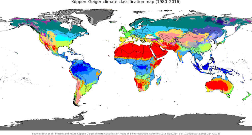
The Grow Map combines an overlay of the 100+ year old Köppen Climate Classification System with map markers to help you find your local climate type. The intent of this map is to be a visual glossary of climate classifications. With it you will be able to see the actual geography that affects climate and how the geography is affected by the climate. You local climate classification will help up at The Grow Network identify your specific needs to become a better gardener and make the most of your growing experience!
LEGEND
BACKGROUND OF THE GROW MAP
The Köppen climate classification is one of the most widely used climate classification systems. It was first published by German-Russian climatologist Wladimir Köppen (1846–1940) in 1884, with several later modifications by Köppen, notably in 1918 and 1936. Later, the climatologist Rudolf Geiger (1894-1981) introduced some changes to the classification system, which is thus sometimes called the Köppen–Geiger climate classification system. The Köppen climate classification divides climates into five main climate groups, with each group being divided based on seasonal precipitation and temperature patterns. The five main groups are A (tropical), B (dry), C (temperate), D (continental), and E (polar). Each group and subgroup is represented by a letter. All climates except for those in the E group are assigned a seasonal precipitation subgroup (the second letter). For example, Af indicates a tropical rainforest climate. The system assigns a temperature subgroup for all groups other than those in the A group, indicated by the third letter for climates in B, C, and D, and the second letter for climates in E. For example, Cfb indicates an oceanic climate with warm summers as indicated by the ending b. Climates are classified based on specific criteria unique to each climate type.
Search the The Grow Map for your local climate classification and email us for advice on growing your own food and making your own medicine.


